Thursday, October 2, 2014

Severe Weather Possible This Afternoon And Evening

Updated 15:56: Tornado Risk changed to Elevated.

Storms are starting to move into the area. Thunderstorms with damaging wind and half dollar sized hail are possible, according to the Springfield National Weather Service.  This afternoon, the storms that develop may be severe. The Storm Prediction Center has much of the Midwest in a slight risk box today, including almost all of Missouri, Arkansas, Illinois and eastern Kansas and Oklahoma, among other states.  You can see this by clicking the Storm Prediction Center - Convective Outlook (Today) link below.

The National Weather Service in Springfield lists today's hazards as:

  • Elevated Limited tornado risk
  • Elevated hail risk
  • Elevated thunderstorm wind damage risk
  • Elevated flooding risk
  • Significant lighting risk
You should stay tuned to local weather forecasts. Make sure your NOAA All Hazards Radio is on and backed up by battery. If you don't own a NOAA All Hazards Radio, you should. Click the link for a previous blog post on selecting one.


Springfield, MO NWS - Hazardous Weather Outlook


Wednesday, October 1, 2014

Severe Weather Possible Today and Tomorrow

Today, the Storm Prediction Center has parts of MO, KS and OK in a slight risk box for severe
weather that is expected this afternoon and evening.  The Springfield National Weather Service lists the potential weather hazards for today as:
  • Limited tornado risk
  • Elevated hail risk
  • Elevated thunderstorm wind damage risk
  • Elevated lightning risk
The NWS expects the main threat to be hail up to golf ball size and damaging wind gusts up to 60MPH.  There will be a limited threat for an isolated tornado or two from SE KS into West Central MO.  Joplin in in this threat area, Springfield is not at the time of this posting.

THURSDAY:  Severe storms are expected Thursday afternoon and evening across the area.  Large hail, damaging wind gusts and isolated tornadoes will be possible with the more intense storms.  

This isn't an expected outbreak of severe weather, but a notice to pay attention.

You should stay tuned to local weather forecasts. Make sure your NOAA All Hazards Radio is on and backed up by battery. If you don't own a NOAA All Hazards Radio, you should. Click the link for a previous blog post on selecting one.

Springfield, MO NWS - Hazardous Weather Outlook


Monday, September 1, 2014

Strong to Severe Weather Expected Later Today


A strong to severe storm system is expected to impact the Ozarks later this afternoon and evening.  The storm prediction center has the area in a slight risk box with a 2% chance of a tornado occurring within the area.  The Springfield National Weather Service lists the threats as:

  • Limited tornado risk
  • Elevated hail risk
  • Elevated thunderstorm wind damage risk
  • Limited flooding risk
  • Significant lightning risk
  • Limited excessive heat risk

The main threat will be damaging wind gusts up to 70MPH and large hail to the size of golf balls.  Frequent lightning is also expected along with a very limited threat of an isolated tornado.

You should stay tuned to local weather forecasts. Make sure your NOAA All Hazards Radio is on and backed up by battery. If you don't own a NOAA All Hazards Radio, you should. Click the link for a previous blog post on selecting one.

Springfield, MO NWS - Hazardous Weather Outlook


Saturday, June 28, 2014

Severe Weather Possible This Afternoon Into Tonight

Severe storms will be possible this afternoon into tonight.  There is currently a Severe Thunderstorm Watch in effect.  The National Weather Service in Springfield, MO lists the risks as:
  • Limited Tornado Risk
  • Elevated Hail Risk
  • Elevated Thunderstorm Wind Damage Risk
  • Limited Flooding Risk
  • Significant Lightning Risk
Additionally, the Storm Prediction Center has most of MO, Eastern KS, much of OK and NW AR in a slight risk box for severe weather, with a 2% chance of a tornado occurring in this area.

You should stay tuned to local weather forecasts. Make sure your NOAA All Hazards Radio is on and backed up by battery. If you don't own a NOAA All Hazards Radio, you should. Click the link for a previous blog post on selecting one.

Springfield, MO NWS - Hazardous Weather Outlook


Monday, June 23, 2014

The Outlaw Chasers - Pilger, NE Footage


The Outlaw Chasers, Randy "Outlaw" Hicks and Lisa, got some amazing footage of the Pilger, NE tornado that sadly did major EF-4 damage to that town.  They have multiple camera angles, including a probe with three cameras that almost took a direct hit.  It produced some amazing up close and personal footage.  If you are a FB user, you can "Like" their page, I would expect more interesting video to follow soon.

There is some language, so if that bothers you, feel free to mute the audio.  However, you will miss some intense sounds.

The Outlaw Chasers FB Page


Monday, May 12, 2014

Severe Storms Possible Later This Afternoon


Severe storms will be possible this afternoon.  The main threat with these storms will be large hail and thunderstorm winds up to 60MPH.

You should stay tuned to local weather forecasts. Make sure your NOAA All Hazards Radio is on and backed up by battery. If you don't own a NOAA All Hazards Radio, you should. Click the link for a previous blog post on selecting one.

Springfield, MO NWS - Hazardous Weather Outlook


Thursday, May 8, 2014

Strong to Severe Storms Possible Later Today

The Storm Prediction Center has almost all of MO, KS, AR and OK in a slight risk box for severe weather today, along with some other states.  Most of this area is in a 2% risk of tornado development, with some of KS and OK in a 5% risk box.

The Springfield National Weather service lists the following risks today as:
  • Limited tornado risk
  • Elevated hail risk
  • Elevated thunderstorm wind damage risk
  • Significant lightning risk
  • Limited non-thunderstorm wind damage risk
A couple of rounds of thunderstorms are likely, with the early storms mainly including the risk of hail.  Later this evening, stronger storms may develop that could include the risks above.

You should stay tuned to local weather forecasts. Make sure your NOAA All Hazards Radio is on and backed up by battery. If you don't own a NOAA All Hazards Radio, you should. Click the link for a previous blog post on selecting one.

Springfield, MO NWS - Hazardous Weather Outlook


Sunday, April 27, 2014

Severe Weather Expected Today

The Storm Prediction Center has MO and AR in a moderate risk box for severe weather today.  There has been quite a bit of talk about an "outbreak" of severe weather today.  The important thing is to have a plan, and pay attention to local weather sources.  The Springfield National Weather Service lists the following hazards expected:

  • Limited tornado risk
  • Significant hail risk
  • Elevated thunderstorm wind damage risk
  • Significant lightning risk

Take note, there has been some discussion of hail to the size of tennis balls.

You should stay tuned to local weather forecasts. Make sure your NOAA All Hazards Radio is on and backed up by battery. If you don't own a NOAA All Hazards Radio, you should. Click the link for a previous blog post on selecting one.

Springfield, MO NWS - Hazardous Weather Outlook


Thursday, April 17, 2014

Experimental Local Storm Reports SPC Page

The SPC introduced an experimental version of the preliminary daily storm report summary through several enhancements on a new webpage.  These enhancements include a new page framework and layout, improved functionality and personalization. More information from each Local Storm Report (LSR) will be accessible, and winter weather LSRs will now be included.

Since this service is experimental, these reports may NOT contain edited, deleted or added reports that are currently performed as needed in the "operational" LSR webpage. Again, LSRs should always be considered PRELIMINARY.

Thursday, April 3, 2014

Severe Weather Expected Later Today

Severe weather is expected to develop today, including an elevated risk for tornadoes.  Please pay special attention today to local real-time weather resources.  The Storm Prediction Center has most of MO and AR, as well as some other areas to the east in a moderate risk box for severe weather.  This includes a hatched area with a 15% probability for a tornado.

The National Weather Service in Springfield, MO lists the risks for the Ozarks as:

  • Elevated tornado risk
  • Significant hail risk
  • Significant thunderstorm wind damage risk
  • Limited flooding risk
  • Significant lightning risk
  • Limited non-thunderstorm wind risk

To the right is an image showing the estimated time for storm initiation.  This could change, so please pay attention to local real-time weather resources.

You should stay tuned to local weather forecasts. Make sure your NOAA All Hazards Radio is on and backed up by battery. If you don't own a NOAA All Hazards Radio, you should. Click the link for a previous blog post on selecting one.

Springfield, MO NWS - Hazardous Weather Outlook


Wednesday, April 2, 2014

Severe Weather Possible Late Wednesday and Into Late Thursday

The Storm Prediction Center has most of MO, KS, OK and AR in a slight risk box for severe weather today.  This does extend east of this area into Southern IL, Western KY, Western TN and NW MS.  The main risks for the Missouri Ozarks, according to the National Weather Service in Springfield, are:

  • Limited tornado risk
  • Elevated hail risk
  • Elevated thunderstorm wind damage risk
  • Limited flooding risk
  • Significant lightning risk
  • Limited non-thunderstorm wind risk
These storms may start forming in the late afternoon time-frame in the eastern KS/OK area, then move through the Missouri Ozarks overnight.

The real concern is Thursday, as the Storm Prediction Center has Southern MO, AR and some areas east in a moderate risk box, and much of the rest of the Midwest in a slight risk box.

You should stay tuned to local weather forecasts. Make sure your NOAA All Hazards Radio is on and backed up by battery. If you don't own a NOAA All Hazards Radio, you should. Click the link for a previous blog post on selecting one.

Springfield, MO NWS - Hazardous Weather Outlook


Thursday, March 27, 2014

Severe Weather Possible Today - 3/27/14

The Storm Prediction Center (see link below) has most of MO, Eastern KS, Northeastern OK, Northern Arkansas and Western IL in a slight risk box for severe weather today.  The Springfield National Weather Service (see link below) lists the following severe weather threats:
  • Limited Tornado Risk
  • Elevated Hail Risk
  • Elevated T-Storm Wind Damage Risk
  • Elevated Lightning Risk
  • Elevated Non-T-Storm Wind Risk

This event should start around 3PM in the SE Kansas area, then move through the Ozarks, exiting the Eastern side of MO by around 1AM.

You should stay tuned to local weather forecasts. Make sure your NOAA All Hazards Radio is on and backed up by battery. If you don't own a NOAA All Hazards Radio, you should. Click the link for a previous blog post on selecting one.

Springfield, MO NWS - Hazardous Weather Outlook


Wednesday, March 26, 2014

Severe Weather Possible Tomorrow - Thursday 3/27/14

It's that time of year folks!  There is a slight risk of severe storms tomorrow.  Now is the time to start thinking about preparedness.  More information later...

You should stay tuned to local weather forecasts. Make sure your NOAA All Hazards Radio is on and backed up by battery. If you don't own a NOAA All Hazards Radio, you should. Click the link for a previous blog post on selecting one.


Wednesday, February 26, 2014

Winter Isn't Over Yet!!!!!

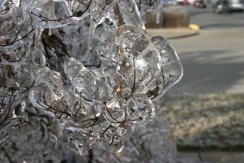
Photo courtesy of Jeff Kerr - KC0VGC
SW MO is looking at another round of snow, sleet, and freezing rain on Friday 2/28 through Sunday 3/2.  You can find the National Weather Service 7 Day Forecast here to keep up with the latest information.

Stay warm folks, temperatures are plunging as well!

Tuesday, February 18, 2014

Spring Is Almost Here - All Hazards Radio Time!

It's almost that time of year!  Do you have an All Hazards Radio?  Is it backed up by battery and ready to go?  You can stall all you want, but Mother Nature will NOT wait.  If you don't own one, I wrote a blog post a few years ago with some advice...read it and get one!

We could see our first round of thunderstorms on Wednesday in the midwest.  Will you be ready?

Monday, February 3, 2014

Ice and Snow Possible Starting Tuesday Morning 2/4/14

Another round of winter precipitation is expected Tuesday morning (2/4/14). Prepare now to avoid delays getting to work, and have a plan for later in the day as the snow and/or ice accumulates.  Below is the Web Briefing Update from the Springfield, MO National Weather Service office.  You can find up to date information real time here.