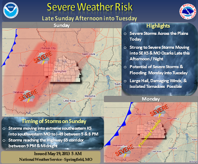
The Springfield NWS lists the threats as:
- Elevated tornado risk
- Significant hail risk
- Significant thunderstorm wind damage risk
- Limited flooding risk
- Significant lightning risk
- Limited non-thunderstorm wind risk
- Limited fog risk
This could be our first big spring storm system, and it will continue through Monday. Please be alert and prepared. Run through your safety plan so you can act on it with short notice.
***Joplin area folks, your weather alert radios may not function properly, please see the NWS URGENT statement regarding the over the air alerting system.***
You should stay tuned to local weather forecasts. Make sure your NOAA All Hazards Radio is on and backed up by battery. If you don't own a NOAA All Hazards Radio, you should. Click the link for a previous blog post on selecting one.


No comments:
Post a Comment